logo
Populate the side area with widgets, images, navigation links and whatever else comes to your mind.
Strömgatan 18, Stockholm, Sweden
(+46) 322.170.71
ouroffice@freestyle.com

Follow us

Follow Us

CONTACT

Budapest, Hungary

Mon - Fri 10.00 - 17.00

 
OFFERING TOOLS FOR BETTER NAVIGATION

GPS

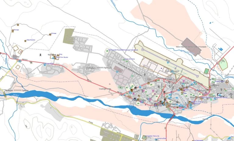
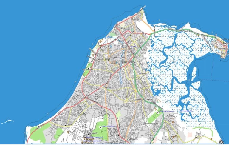
GPS MAP FOR GARMIN OR FOR ANDROID DEVICES

2025 BUDAPEST-BAMAKO, COMPLETE WEST AFRICA GPS MAP FOR GARMIN COMAPTIBLE DEVICES AND ANDROID DEVICES

The map contains all the paved roads, unpaved roads, pistes all along the route of Budapest-Bamako 2025. The map also contains the GPS coordinates provided by the organizers, just like bivouacs, check points, accommodations, shops and detours. We upload the maps the day before the start or at the first African campsite to your GPS or Android device. One purchase – one device, if you wish us to upload the maps to more devices, you will have to purchase the maps for each of them.

Budapest-Bamako

Requirements:
Garmin GPS device, Android tablet with OruxMaps application. The map may run on other devices as well. If for some reason it doesn’t operate on your GPS device, we will give you a full refund.

DELUXE SATELLITE MAP

OFFLINE SATELLITE AND TOPOGRAPHIC MAP FOR ANDROID DEVICES, FOR THE ROUTE OF THE 2025 BUDAPEST-BAMAKO (COMPLETE WEST AFRICA MAP DELIVERED ON 128GB SD CARD)

This is a very detailed satellite map, that contains all the main, paved roads, dirt roads, pistes and tracks along the route of the rally. Every track, donkey path, river crossing, mountain or manmade structure is there. No Internet connection is needed. The map also contains the GPS coordinates provided by the organizers, just like bivouacs, check points, accommodations, shops and detours. The satellite map contains only the African section of the rally, focused on the route of the Racing category. Besides this, you will get the complete Garmin topographical map. The micro SD Card with the maps will be handed over on the day before the start at the first African campsite.
Requirements:
Android tablet with OruxMaps application, with micro SD card slot.

SAVE BIG TODAY

RESERVE NOW. PRICES WILL CHANGE ON OCTOBER 1, 2024.

  • B2B GARMIN BASIC MAP
  • 40 per installation
    • All towns and villages with detailed street maps in West Africa along the rally route.
    • Installation in Budapest or Tangier
    • Detailed information available on the Team Info site, in downloads point. You can purchase the maps in Finance point.
  • ORDER NOW
  • B2B GARMIN FULL MAP
  • 60 per installation
    • All towns and villages with detailed street maps for West Africa along the rally route.
    • Complete topographic maps: tracks, dirt roads, donkey paths, river crossings
    • Rally camps, danger points, roadbook points, sights and attraction, meeting points, hotel, stores and secret points.
    • Calculating route with Garmin GPS devices
    • Installation in Budapest or Tangier
    • Detailed information available on the Team Info site, in downloads point. You can purchase the maps in Finance point.
  • ORDER NOW
  • B2B DELUXE ANDROID MAP
  • 200 per SD card
    • Very detailed satellite map about the African leg of the racing category
    • All towns and villages with detailed street maps in West Africa along the rally route.
    • Complete topographic maps: tracks, dirt roads, donkey paths, river crossings
    • Detailed satellite view of the area, with sand dunes, paths, villages, that are known only among the local people
    • Rally camps, danger points, roadbook points, sights and attraction, meeting points, hotel, stores and secret points.
    • The micro SD Card with the maps will be handed over on the day before the start at the first African campsite.
    • Detailed information available on the Team Info site, in downloads point. You can purchase the maps in Finance point.
  • ORDER NOW

QUESTIONS?

CHECK OUT OUR FACEBOOK GPS TOPIC